 சினிமா
 டிவி
டிவி Podcast
 iPaper
 கோயில்கள்
 புத்தகங்கள்
 Subscription
 திருக்குறள்
 கடல் தாமரை
Remote Sensing Engineering: A Career in Mapping the Earth from Space
Remote Sensing Engineering: A Career in Mapping the Earth from Space
ஜூலை 30, 2026 03:39 PM
ஜூலை 30, 2026 03:39 PM

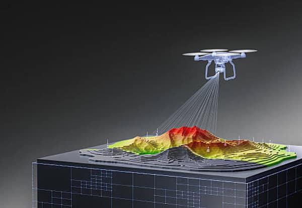
Remote Sensing Engineering is an emerging branch of engineering that focuses on collecting, analysing and interpreting information about the Earth's surface without making direct physical contact. Using data captured by satellites, drones, aircraft and other advanced sensing systems, the technology provides valuable insights into land, water, forests, weather and environmental conditions.
Today, remote sensing has become an indispensable tool in agriculture, forestry, water resource management, urban planning, climate change studies and disaster management. It also plays a vital role in environmental conservation, enabling governments, researchers and industries to make informed decisions based on accurate geospatial information.
What Students Learn
The undergraduate programme introduces students to subjects such as geology, atmospheric science, satellite technology, geoinformatics, digital image processing, Geographic Information Systems (GIS) and statistical data analysis. These courses equip students with the technical knowledge required to process and interpret spatial data collected from remote sensing platforms.
Students aspiring to pursue a bachelor's degree in Remote Sensing Engineering should have completed Class 12 with Physics, Chemistry and Mathematics as their core subjects.
At the postgraduate level, the curriculum becomes more specialised, covering advanced satellite image analysis, microwave remote sensing, spectral signal processing, 3D terrain modelling, spatial databases and geospatial data management. The programme also includes laboratory sessions, industrial training and research projects that provide valuable hands-on experience.
Candidates seeking admission to postgraduate programmes are generally required to hold a B.E./B.Tech. degree in Civil Engineering, Geomatics, Computer Science or related disciplines, or a B.Sc./M.Sc. degree in Geography, Geology, Geoinformatics, Information Technology or allied fields.
Expanding Career Opportunities
The growing use of geospatial technologies has opened up diverse career opportunities for remote sensing professionals. Graduates are employed by organisations such as the Indian Space Research Organisation (ISRO), National Remote Sensing Centre (NRSC), Defence Research and Development Organisation (DRDO), Forest Departments, Geological Survey organisations and disaster management agencies.
The private sector also offers promising careers in agriculture, infrastructure development, urban planning, transportation, mining, environmental consultancy, GIS services and natural resource management.
A Promising Future
The future of Remote Sensing Engineering is closely linked to technological advancements and the increasing need for sustainable development. As countries invest in monitoring climate change, managing natural resources and building smart cities, the demand for professionals with expertise in remote sensing and geospatial technologies continues to rise.
The integration of Artificial Intelligence (AI), Machine Learning (ML), Big Data analytics and cloud computing with remote sensing is transforming the way geospatial information is collected and analysed. These innovations are creating exciting opportunities in research, industry and public service.
With expanding applications across multiple sectors and growing investments in space technology, Remote Sensing Engineering is fast emerging as a rewarding career option for students interested in science, technology and environmental sustainability.

Advertisement